State of the Market in Anniedale-Tynehead 2019
What is happening in Anniedale-Tynehead & why it matters.
The last 12 months have been a rollercoaster of activity in Anniedale-Tynehead, as the development land market picked up and progress was made on a servicing solution for the neighbourhood. This progress included the approval of the servicing cost sharing agreement and conditional approval of the first residential development application. These events, along with a rumor that the necessary funding for servicing would be committed in July, created a flurry of purchasing activity from land investors. However, the funding was not committed and renewed uncertainty regarding the timeline to development in Anniedale-Tynehead has put many of those same purchasers on pause, with the concern servicing could take longer than anticipated.
A healthy demand for efficient development properties exists, although the general downturn in the real estate market and unknown timeline to development has buyers more cautious than last year.
As the costs for servicing (sanitary, water, etc.) and timeline to development vary widely across the neighbourhood, land values vary as well. We’ve elaborated on this below, in the “Land Value Trends” section of this article. The red and yellow outlines on the map below show the two areas with the highest concentrations of land transactions over the past 18 months. Interest from purchasers has been concentrated here in large part because these areas will be the first to be serviced.
Modifications to Existing Land Use
In last year’s report we noted the possibility of changes to the existing land use plan and how those changes may necessitate a comprehensive review of the entire neighbourhood plan. This has since been deemed unlikely and instead, each application for a Neighbourhood Community Plan amendment will trigger a review of a small surrounding area. There have been very few development applications submitted thus far so it’s too early to determine the specific implications of this.
Land value trends
Property values in Anniedale-Tynehead and South Port Kells are primarily driven by a property’s specific land use designation and its timeline to development. Land transactions from the past 18 months follow this trend, with the highest prices being paid closest to Highway 15 where servicing is anticipated to occur first and where the land use designations hold the highest densities. Sale prices cascade downward to the west and east. This trend is expressed in the image below with the darkest blue areas highlighting the highest property values and the lightest blue areas highlighting the lowest land values.
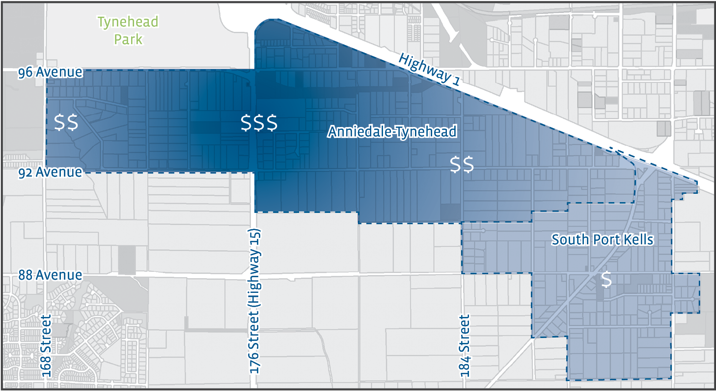
The other trend we’re seeing is that land values within the South Port Kells neighbourhood do not vary like they do in Anniedale-Tynehead. This is largely due to the lack of a neighbourhood plan for South Port Kells. Without the neighbourhood plan’s land use map, purchasers do not know what the future development potential is for any one property and so all properties are given roughly the same value.
If you have questions, we’re happy to share what we know about the future of the neighbourhood. Please don’t hesitate to contact me.
Sources: Commercial Edge, MLS, City of Surrey